You found a “gulf‑access” home in Bonita Springs, but will your boat actually make it from the dock to open water without stress or damage? That is the question that separates a great purchase from a frustrating one. You want smooth, reliable access that fits your boat’s draft, air‑draft, and beam, not just a listing description.
In this guide, you’ll learn how Bonita Springs canals differ, how to read depths and bridge clearances, what dredging and seagrass rules can mean for access, and exactly what to verify before you buy. Let’s dive in.
What gulf access really means
Not all routes are equal. Some homes sit near the passes and get you to the Gulf quickly. Others require long, slow runs along tidal rivers and narrow canals where depth and width change by block.
Estero Bay and passes
Estero Bay connects local canals to the Gulf. Passes like Wiggins are actively managed and can change with each maintenance cycle. Collier County’s updates on Wiggins Pass dredging show how projects can reset channel depth and even adjust alignment. When dredging is in progress or just completed, expect temporary aids to navigation and shifting shoals.
What this means for you: lots that route through Wiggins or similar passes often offer short runs to open water, but draft still matters across interior seagrass flats and bay shallows.
Imperial River and Spring Creek
Many Bonita Springs neighborhoods reach the bay via the Imperial River or Spring Creek. These are tidal, winding, and narrow in places. The Spring Creek vulnerability assessment notes channel pinch points and bottom elevations that can control turning room and maximum practical boat size. A property that looks connected on a map may require longer no‑wake transits and tight maneuvers around bends and under bridges.
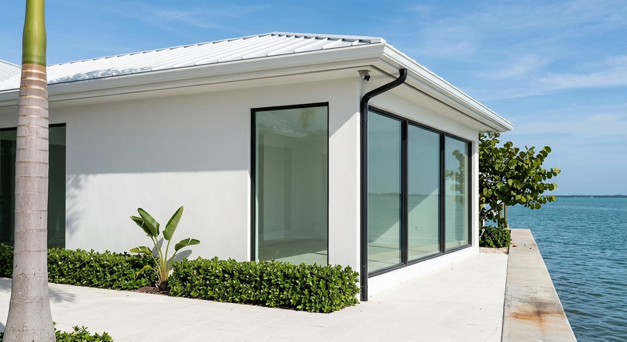
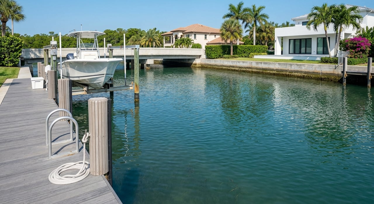
Residential canals and marinas
Managed communities with marinas, like Bonita Bay Marina, usually publish slip dimensions, lift capacities, and rules. They may also coordinate community dredging. Independent residential canals vary widely. Some were engineered with deeper basins. Others are shallow spurs with limited turning room. Always confirm depths at Mean Lower Low Water and who funds dredging.
Four numbers that decide fit
Getting the right canal is about four measurements: depth, tide, bridge clearance, and usable width.
Depth and datums
Charted depths on U.S. coastal charts are reduced to a low‑water datum, commonly Mean Lower Low Water. That makes them conservative baseline numbers. Your safe clearance depends on the charted depth, the predicted tide at the time you travel, and a safety margin under your keel. If a seller quotes a depth, confirm the datum. For background on how depths are shown, see NOAA’s guidance in the Nautical Chart User’s Manual.
Local tides
Tide range in Estero Bay is modest compared to the Atlantic, yet a foot of water can be the difference between smooth passage and a prop strike. Use the local NOAA station for predictions. The Estero River station page provides real‑time and forecast water levels: NOAA Tides & Currents — Estero River.
Bridge clearance
Published bridge clearances are typically referenced to a high‑water datum. At higher tides, you have less air gap. Compare your boat’s loaded air‑draft to the bridge clearance after correcting for the tide stage and keep a safety margin of a few feet for antennas and variable water levels. The U.S. Coast Pilot covers how clearances and opening rules are listed. See the United States Coast Pilot, Volume 5 for context.
Width and turning room
A canal’s usable width can be much less than it looks on a map once you account for finger piers, pilings, and no‑wake rules. Confirm the berth width between pilings, lift capacity, and any HOA or marina beam limits. Community marinas often publish these details, as in the Bonita Bay Marina rules and specs.
Do the tide math
Here is a simple example to show how to translate charted depths into real‑world clearance.
- Charted depth at the dock approach: 4.0 ft (MLLW)
- Your boat’s draft: 3.5 ft
- Predicted tide at transit: +1.0 ft above MLLW
Usable water at transit is charted depth plus tide: 4.0 + 1.0 = 5.0 ft. Your boat draws 3.5 ft, so under‑keel clearance is 5.0 − 3.5 = 1.5 ft. At a true low tide with no positive tide boost, you would have only 0.5 ft. That is tight and may require scheduling runs at higher water.
Rule of thumb: target at least 1 to 2 ft of under‑keel clearance at MLLW and a few feet of vertical margin at bridges, after applying the correct datum. When numbers do not pencil out, consider a marina slip rather than relying on a private dock.
Shoaling and seasonal change
Bottoms move. Seasonal currents and storms can shift shoals, especially near inlets and canal mouths. That is why counties periodically dredge passes. For instance, Wiggins Pass dredging updates show that maintenance is recurring and conditions evolve. Private canal mouths can shoal between maintenance cycles. Where seagrass is present, dredging windows and footprints are limited, which can increase cost and delay approvals. Estero Bay’s mapped seagrass beds are documented in the Seagrass Integrated Mapping and Monitoring resources.
Permits and maintenance
Who issues permits
Dock, seawall, and shoreline work within the city limits is administered through the City of Bonita Springs Community Development. The city recently updated code sections for docks, dredging, and benthic assessments. Start with the city’s dock and shoreline permitting update, then search permits by address. Deeper dredging or channel changes typically require state and federal approvals as well. The U.S. Army Corps of Engineers posts regional applications and decisions on its public notices page, such as those listed by the USACE Jacksonville District.
Seagrass constraints
Estero Bay contains mapped seagrass that can constrain dredging footprints and trigger mitigation. Ask for any habitat impact documentation and permit conditions, and whether compensatory mitigation was required. The SIMM program outlines mapping and monitoring, as summarized in the seagrass overview.
Who pays for dredging
Responsibility varies by community. Some HOAs or CDDs fund community dredging, but many independent canal owners share or individually fund maintenance. Regional plans note that older channel dimensions can sometimes be maintained if you can document original conditions, yet approvals are case by case. See the discussion in the Lee County plan document.
Buyer due‑diligence checklist
Build these items into your offer as contingencies where possible. They will save you time and money later.
- Recent bathymetric survey at the dock and approach, referenced to MLLW. If none exists, plan to run independent soundings at low tide. The NOAA chart user manual explains why datum matters.
- A marked route map from the dock to the Gulf showing every bridge, marked channel, and shallow control point, with notes on charted depths and bridge clearances and their datums.
- Copies of all permits and as‑built drawings for the dock, seawall, lifts, and any prior dredging. Check the City of Bonita Springs permitting portal and any HOA records.
- Seagrass or habitat impact documents and any compensatory mitigation conditions tied to dredging approvals. Reference the seagrass mapping resources.
- Marina or HOA slip rules: max length overall, beam, lift capacity, and any waitlists. Communities like Bonita Bay Marina publish helpful benchmarks.
- Bridge tables and any Local Notice to Mariners updates for drawbridge schedules or channel changes. The Coast Pilot explains where these details are recorded.
- If dredging was performed or is likely needed, pull the state and federal permits or maintenance agreements, and check recent USACE public notices at the Jacksonville District page.
Tip for requests: ask the seller to provide “a recent hydrographic survey at MLLW covering the dock face and approach, copies of all dock/seawall/dredge permits and any maintenance or assessment agreements, and current HOA or marina slip rules.”
Match boat to canal type
Use these starting points, then verify with local data and a survey at low tide.
- Small flats, pontoons, and center consoles with shallow drafts often work in most residential canals and bayfront lots that are not marked shallow. Still verify the narrowest point on your route.
- Mid‑size center consoles and express cruisers need maintained approaches and prefer canals where MLLW depth plus typical tide leaves at least 1 to 2 ft under the keel.
- Trawlers, larger cruisers, and many monohull sailboats usually require deeper channels and routes without low fixed bridges unless there is a drawbridge. Many of these vessels favor marina basins or outer‑harbor slips.
- Catamarans and centerboard sailboats can have shallow drafts but wide beams. Confirm berth width between pilings and whether a lift can accommodate your hull form.
Bottom line: target 1 to 2 ft of under‑keel clearance at MLLW and a few feet of vertical margin at bridges, after correcting for tide and datum.
Local expertise on your side
Picking the right canal is part nautical math and part local knowledge. You need clear answers on depth, bridge clearance, turning room, permitting risk, and long‑term maintenance costs. If you want a straight, technical plan for your specific boat and route, work with a waterfront agent who understands both the market and the mechanics.
If you are weighing Bonita Springs waterfront options, connect with Jonathan Gunger. With builder‑level experience in docks, seawalls, and permitting, Jonathan can help you line up surveys, read charts and tide data, review permits, and choose the property that truly fits your boat and your lifestyle.
FAQs
What does “gulf access” mean in Bonita Springs?
- It describes a route from your dock through canals, rivers, and Estero Bay to the Gulf. Routes differ in depth, width, and bridges, and may rely on inlets that are periodically dredged, such as Wiggins Pass.
How do I factor tides into depth at my dock?
- Start with charted depth at MLLW, then add the predicted tide at your transit time from the local NOAA station, like the Estero River page. Aim for 1 to 2 ft of under‑keel clearance.
How do I check bridge clearance for my boat?
- Compare your loaded air‑draft to published bridge clearance after correcting for tide and datum. Keep a few feet of margin. The Coast Pilot explains how clearances are listed and where to find opening rules.
Do seagrass rules affect dredging near my property?
- Yes. Mapped seagrass beds in Estero Bay can limit dredging footprints, increase mitigation costs, and affect timing. Review habitat documentation and permits, using references like the seagrass mapping overview.
Who issues permits for docks and dredging in Bonita Springs?
- The City of Bonita Springs handles local shoreline and dock permits, with state and federal approvals often required for dredging. Start with the city’s permitting update and check the USACE public notices.
Who pays for maintenance dredging on a private canal?
- It depends. Some communities fund dredging, while many independent canal owners share costs or pay individually. Regional guidance notes that maintaining older channel dimensions can be possible with documentation. See the Lee County plan document.