If getting from your dock to open Gulf waters is your weekend plan, Bonita Springs gives you options. The twist is that “Gulf access” can mean very different things here, from beachfront to tidal canals to river routes and marinas. Your best fit depends on your boat, how you cruise, and how much maintenance and exposure you are comfortable with. In this guide, you will learn the types of Gulf access, the Bonita Springs areas boaters often explore, and a smart checklist to confirm a property truly matches your vessel and lifestyle. Let’s dive in.
What “Gulf access” means here
Not all Gulf access is the same. Understanding these pathways helps you narrow your search and avoid surprises after closing.
Gulf-front and barrier islands
These are homes directly on the Gulf or on barrier islands like Bonita Beach and the Little Hickory Island area. You get instant beach and sunset living. Boating here often means shallow-draft runs, kayaking, and launching offshore trips from a nearby marina. There is no canal to navigate, but coastal exposure is higher and private deep-water docks are limited.
Tidal canals with Gulf access
Many buyers picture a home on a canal with a straight shot to open water. In Bonita Springs, tidal canals connect to rivers or passes, which then lead to the Gulf. These canals can suit center consoles and family fishing boats, but depth varies by tide and dredging history. Always confirm mean low-water depths, channel markers, and any bridge or beam limits before you commit.
River routes to the Gulf
The Imperial River is the main corridor, feeding out to the Gulf through nearby passes. These routes can support longer runs and a range of boats when channels are maintained. Pass mouths shift with sand, so you want current charted depths and local advisories. Check NOAA nautical charts and the U.S. Coast Guard’s Local Notice to Mariners for the latest on aids to navigation and shoaling.
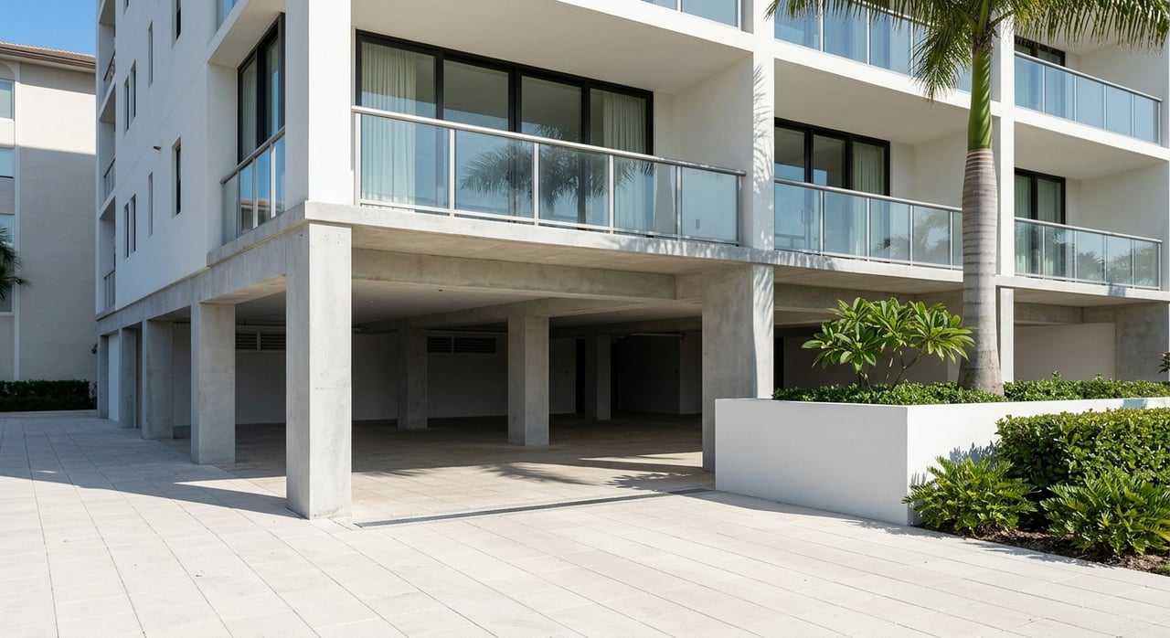
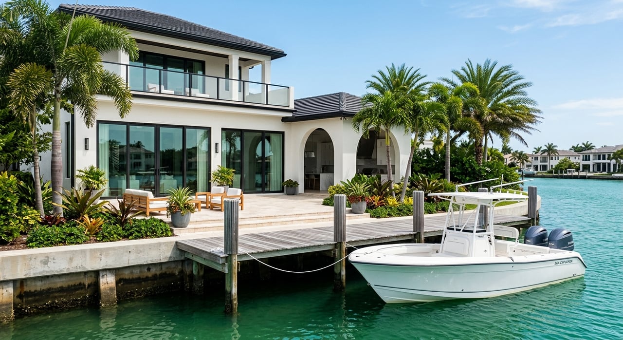
Marina-based access
If you prefer a slip over a private dock, community and commercial marinas can be ideal. Deep-water marinas often handle larger boats than residential canals. Slip sizes, depths, services, and waitlists vary. Ask for written specs, including maximum length overall, beam, and draft, and verify fuel and pump-out services.
Standout areas to explore
Every community changes over time, so treat the notes below as a starting point. Always confirm details with the association or marina manager before you make an offer.
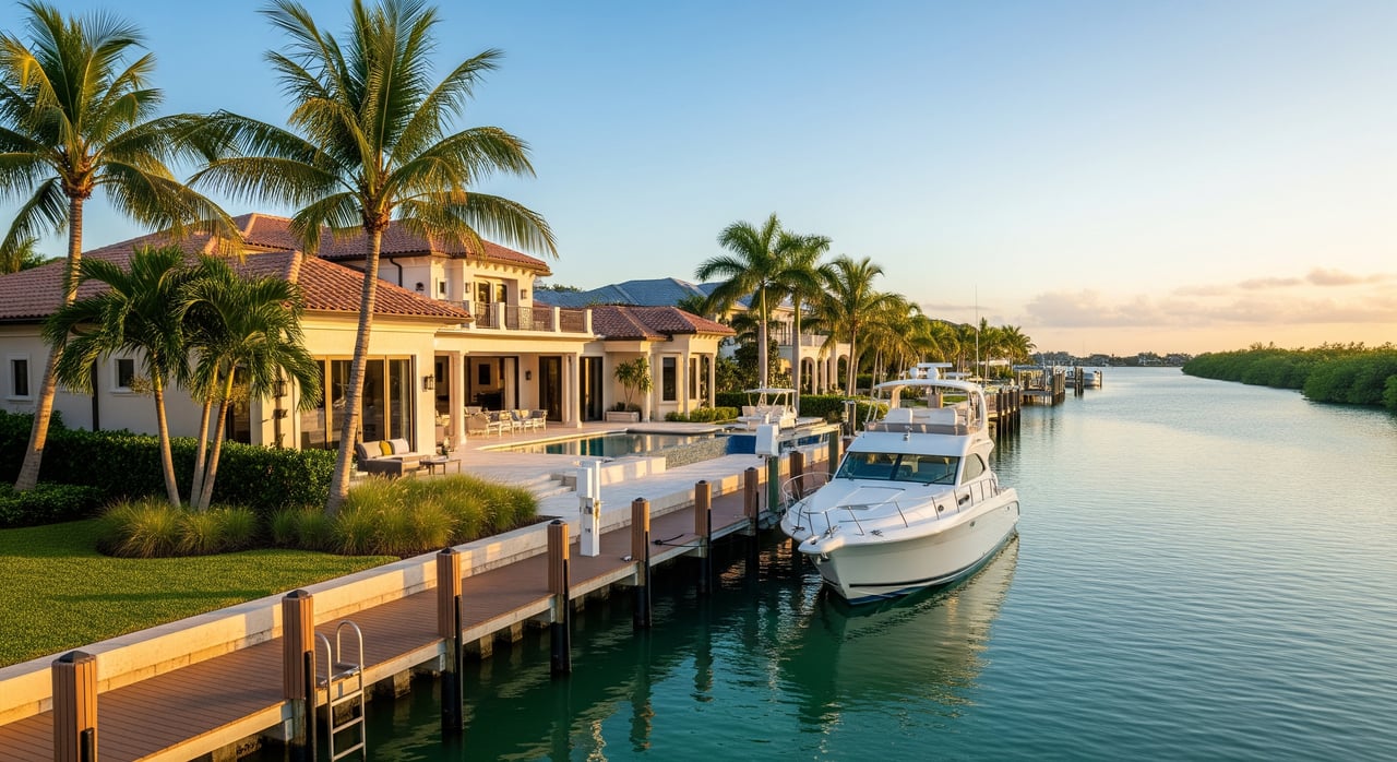
Bonita Bay
Bonita Bay is a well-known master-planned community with marina access and yacht-club style amenities. Community marinas typically offer wet slips and services like fuel and pump-out, with a range of slip sizes depending on the facility. Ask about HOA rules, slip waitlists, and dredging schedules to understand both access and ongoing costs.
Pelican Landing and the Imperial River
Pelican Landing and nearby neighborhoods along the Imperial River offer riverfront access leading toward Wiggins Pass. Many buyers favor this corridor for day cruising, fishing, and beach runs. Bridge clearances and river shoaling are important checks here. Confirm air-draft limits and review any updates on channel conditions through Local Notice to Mariners.
Bonita Beach and barrier-island streets
Gulf-front homes and condos in the Bonita Beach and Little Hickory Island area deliver the classic beach lifestyle. Some homes near channel mouths have private docks, though many properties prioritize sand and views over deep-water mooring. Because coastal exposure is higher here, carefully review wind and hurricane insurance requirements and any dune or shoreline rules in county records.
Other canal and gated communities
Beyond the larger names, you will find smaller canal neighborhoods with community docks or private slips. Canal depth, width, and maintenance are the big variables. Ask who maintains the canals, how often dredging occurs, and whether there are boat-size limits. A short list of written rules and recent maintenance records will help you avoid guesswork.
Boat size, bridges, and depth
Your boat’s LOA, beam, draft, and height drive your neighborhood choices.
- Shallow residential canals often run about 2 to 6 feet at low tide, which suits skiffs and flats boats.
- Moderately deep canals and marina approaches commonly offer 6 to 10 plus feet at mean low water, fitting many center consoles and bay boats.
- Deep-water marina channels may reach 10 to 20 plus feet, which helps larger offshore boats and cruisers. Always verify local soundings and mean low-water measurements.
Many residential canals can fit boats in the 25 to 35 foot range, depending on canal width, depth, and dock layout. Community marinas often offer slips in the 30 to 50 foot range, with larger marinas sometimes reaching 60 to 100 plus feet. These are practical ranges, not guarantees. Get exact slip dimensions, fairway depth, and community rules in writing before you schedule a survey or move a boat.
Bridge clearance is another key factor, especially for sailboats and flybridge yachts. Map your route to the Gulf and note every fixed bridge, then confirm published clearances on NOAA charts and with local notices on the USCG Navigation Center. For Wiggins Pass and similar pass mouths, plan for shifting sand and seasonal change, and check new advisories before each run.
Locks and water-level control gates are uncommon in the Bonita Springs area. Most canals and river routes are tidal. If a community references locks or gates, ask the HOA or marina manager for written details so you know exactly what to expect.
Buyer due diligence checklist
Use this checklist to confirm a property’s real, day-to-day access before you make an offer.
Before you write an offer
- Obtain a written marina or dock profile with max LOA, beam, draft, mean low-water depth at the slip, length of dock face, and finger configuration.
- Request dredging and maintenance records, including last dredge date, permits, and any scheduled work.
- Ask the HOA or association for boat rules and policies, including slip assignment or leasing, size limits, guest-slip rules, fees, transferability, and waitlist procedures.
Navigation and environmental checks
- Review the route on authoritative sources like NOAA nautical charts and the Local Notice to Mariners for aids and shoaling advisories.
- Confirm any environmental limits through the Florida Department of Environmental Protection and the U.S. Army Corps of Engineers for permits and mitigation history.
- For local permits, property records, and county-managed ramp or marina info, consult Lee County Government resources.
Onsite and technical verification
- Arrange a depth-sounding at mean low water along the route and at the slip, using a professional sonar survey for larger vessels.
- Confirm bridge clearances against your boat’s air draft and verify during an in-person visit.
- Visit at low tide and after wind events, and speak with marina managers and slip holders about seasonal shoaling and navigation pinch points.
Title, legal, and insurance items
- Verify recorded riparian rights and any dock-related easements in the deed and title documents.
- If a slip is leased or assigned by an HOA, review the lease terms and transfer rules in writing.
- Discuss wind and hurricane insurance, marina liability, and any insurer limits on vessel size or type with your carrier.
Operational and cost planning
- Ask for a schedule of fees, utilities, pump-out and fuel availability, and any haul-out capacity.
- Confirm dock maintenance responsibility, cost-sharing, and special assessments in HOA documents.
- Ask about hurricane-secure haul-out options, evacuation plans, and seasonal storage choices. The Florida Fish and Wildlife Conservation Commission provides boating safety and rules that are useful as you plan operations.
Hurricane and insurance planning
Coastal access brings weather and insurance considerations. Budget for wind coverage and plan for how you will secure your boat in a storm. If you rely on a community marina, ask about storm protocols, haul-out capacity, and priority rules. For single-family docks, evaluate seawall condition, piling heights, and tie-off options, then confirm any planned improvements with permits and engineering in place.
Matching neighborhood to lifestyle
Think about how you will actually use the water. If you want fast runs to the beach and restaurants, a river route with maintained markers can work well. If you prefer larger offshore days and overnight trips, a deep-water marina slip may be the simplest answer. If your heart is set on Gulf-front sunsets, plan to pair that lifestyle with a marina membership or trailer options nearby.
How to move forward
Start with your boat’s specs, your cruising style, and your risk comfort on tides and passes. Shortlist a few communities, then verify depth, bridges, and rules one by one. Lean on authoritative sources for navigation and permitting. Use NOAA charts, the USCG Navigation Center, the Florida DEP, the U.S. Army Corps of Engineers, and Lee County for local records and updates.
Ready to explore Gulf access?
If you want a property that truly fits your boat and your lifestyle, work with a local who understands both the luxury market and the waterfront details. As a licensed contractor and waterfront specialist, I can help you evaluate seawalls, docks, permits, and long-term resiliency while you compare communities and slips. When you are ready for a focused search or a second opinion on a property’s access, reach out to Jonathan Gunger for clear, practical guidance.
FAQs
How do I verify a Bonita Springs canal fits my boat?
- Get written slip specs, run a depth survey at mean low water, and confirm bridge clearances with NOAA charts and the Local Notice to Mariners.
Are marine locks common on routes to the Gulf?
- No, most waterways are tidal and do not use locks, but confirm with the specific HOA or marina in writing.
Who maintains dredging for residential canals?
- It varies by location, so request written maintenance agreements and recent dredging records from the HOA, county, or improvement district.
What environmental rules can affect docks or dredging?
- Seagrass protections and permits may apply, so check the Florida DEP and the U.S. Army Corps of Engineers for active requirements.
How dynamic is Wiggins Pass for navigation?
- Pass mouths can shoal and shift, so review updated charted depths on NOAA charts and new advisories via the USCG Navigation Center.
What boat sizes do canal homes usually support?
- Many residential canals accommodate about 25 to 35 feet, but exact fit depends on canal width, depth, dock layout, and community rules, all of which must be verified in writing.