Picture yourself stepping onto your dock at sunrise, coffee in hand, water shimmering in front of you. Now decide: do you want the open sweep of the Caloosahatchee River, or the quiet shelter of a Fort Myers canal? Both deliver the Southwest Florida lifestyle, but they come with different flood profiles, insurance realities, boating experiences and upkeep needs. In this guide, you’ll learn how riverfront and canal homes compare on risk, cost and everyday living so you can choose with confidence. Let’s dive in.
Riverfront vs canal: what it means
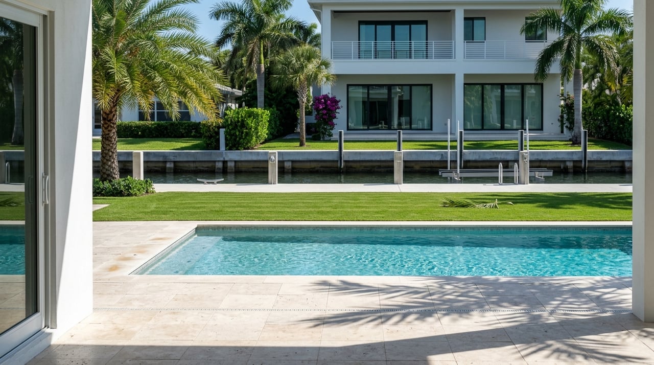
Riverfront homes sit directly on the Caloosahatchee River, the tidal waterway that runs past downtown Fort Myers into San Carlos Bay and the Gulf. You get deeper, more navigable water and generally quicker open-water access for larger boats. That also means more exposure to tidal storm surge that can travel inland during hurricanes. NOAA’s storm surge resources explain how surge can push far up rivers and bays.
Canal-front homes line man-made or tidal canals connected to the river or local drainage networks. These canals vary widely in width and depth. You often enjoy calmer water, less through-traffic and smaller wakes, which can boost day-to-day privacy. Boat size and movement can be limited by canal depth and any bridge clearances. Always verify the canal’s typical depth and clearances for your intended vessel.
Flood exposure essentials
Riverfront surge path
Because the Caloosahatchee is tidal, coastal surge can move upriver and raise water levels well inland. Events like Hurricane Ian showed how surge and heavy rain can combine to produce severe flooding in Fort Myers and across Lee County. You should evaluate each address, even if it looks elevated, because surge pathways and local topography vary. Review flood hazards using FEMA and county tools before you fall in love with the view.
- Start with FEMA’s Flood Map Service Center to pull a property-specific FIRMette and see zones and base flood elevations where available. You can access it on the FEMA Map Service Center.
- Then use Lee County’s flood resources to view current and proposed panels. The county notes that mapping updates can shift properties between categories, which can change lending and insurance requirements. Check the latest information on Lee County’s flood map page.
Canal flooding patterns
Canal homes typically see fewer everyday wakes, but they are not immune to flooding. During major storm surge or extreme rainfall, some canals can overtop or backflow. Depth, canal connectivity to the river, and neighborhood drainage all matter. FEMA maps are a regulatory baseline and do not capture every local source of water. Pair the maps with an Elevation Certificate and an on-site assessment to understand real-world risk.
Insurance and cost drivers
Risk Rating 2.0 in plain English
FEMA’s Risk Rating 2.0 changed how the National Flood Insurance Program prices policies. The method looks at distance to multiple water sources, flood frequency, replacement cost and elevation. Two homes on the same street can have different premiums because of small differences in elevation or proximity to tidal water. Get NFIP and private flood quotes early and request that quotes use the latest Elevation Certificate. Learn what drives pricing in this overview of Risk Rating 2.0.
Citizens flood requirement update
If you expect to insure with Florida’s Citizens Property Insurance, know that the state has phased in flood insurance requirements for some Citizens policyholders based on dwelling value. This affects buyers’ required coverage and documentation. Review the current implementation schedule described in this Citizens flood requirement update, and confirm details with your insurance professional.
Local discounts that matter
Lee County participates in FEMA’s Community Rating System. Policyholders in unincorporated Lee County currently qualify for a significant NFIP premium discount tied to the county’s CRS rating. Discount levels can vary by municipality, so confirm the property’s location and credit. See the program details on Lee County’s CRS discount page.
Practical quoting tips
- Being in a Special Flood Hazard Area, lower finished-floor elevation relative to BFE, high replacement cost and prior claims can raise premiums. Elevation, engineered flood vents and documented mitigation can help reduce them. You can explore key factors in this Risk Rating 2.0 guide.
- For context on claims patterns at the county or census-tract level, review the anonymized NFIP datasets on OpenFEMA. These are best for aggregated insights, not property-level histories.
Boating traffic and privacy
Riverfront activity and wakes
Riverfront properties, especially near the River District and marinas, see more visible traffic, including transient vessels and tour boats. Slow or idle-speed zones reduce wakes in sensitive stretches, and seasonal patterns can change travel times. You can review local boating advisories and slow-speed information through this auxiliary resource.
Canal calm with size limits
Canal homes tend to be quieter on most days, with smaller wakes and more relaxed dock use. That can be a big plus for privacy, paddleboards and pets. The tradeoff is maneuvering room and draft. Narrower canals and bridge clearances can limit boat size and turning radius. Before you offer, confirm canal depth at low tide, any posted restrictions and the practical path to the river or bay.
Environmental impacts and upkeep
Wakes, erosion and seagrass
Boat wakes and propeller scarring can erode shorelines and damage seagrass beds that help stabilize sediments. Over time, that can stress seawalls, increase maintenance and reduce water clarity. Studies of Florida estuaries link boating pressure and wave action to seagrass loss. If you value sheltered, intact shorelines, factor wake exposure into your shortlist. For background on impacts, see this peer-reviewed summary of boating effects on seagrass.
Seawalls, docks and permits
Both riverfront and canal properties come with waterfront infrastructure that needs upkeep. Seawalls, docks and lifts have life cycles, and repairs require permits from layers that can include the city or county, Florida DEP and sometimes the U.S. Army Corps. Permits often include conditions to protect seagrass and manatees, which can add timing and cost. For a sense of cost categories and shoreline approaches, review this shoreline erosion and protection guide. Always get site-specific estimates from local marine contractors.
Neighborhood snapshots
These quick notes are starting points. Always confirm zones, elevations and permits for the specific address you are considering.
Downtown River District, riverfront
- What you get: walkable access to dining and marinas, active river views, convenient slips. Expect more visible boat traffic and evening activity.
- Risk lens: several areas along the river sit in Special Flood Hazard Areas. Check both current and proposed maps on Lee County’s flood page and review an Elevation Certificate.
McGregor corridor, riverfront
- What you get: established riverfront estates, deep-water access on many parcels and strong long-term demand for views and frontage.
- Risk lens: direct river exposure means surge sensitivity if the lot sits low. Verify seawall history, dock condition and flood zone status with Lee County’s mapping tools.
Town & River Estates and Whiskey Creek, canal
- What you get: deeded canal communities, calmer day-to-day water and private docks. Canal width and draft vary by street.
- Risk lens: canals can still flood in extreme events. Confirm connectivity to the river, typical depths and any dredging obligations with the HOA and your contractor.
Iona and Fort Myers Country Club area, mix
- What you get: a mix of canal and river-proximate options at varied price points. Access to marinas can be convenient with the right address.
- Risk lens: elevations and zones are mixed. Use FEMA and county tools to compare specific parcels and request quotes early.
Buyer checklist
Use this due diligence list for any riverfront or canal-front offer.
- Maps and zones: pull a property-specific FIRMette on the FEMA Map Service Center. Note the flood zone and any base flood elevation.
- County cross-check: confirm current and proposed panels on Lee County’s flood page. Ask whether the parcel sits in unincorporated or incorporated territory, since CRS discounts can differ.
- Elevation and history: request an Elevation Certificate from the seller or budget for a new survey. Ask for any seller disclosures on past flooding. For market context, review county-level patterns in OpenFEMA’s claims dataset.
- Quotes and coverage: obtain an NFIP quote and at least two private flood quotes. Have agents explain rating factors under Risk Rating 2.0. If you plan to use Citizens, confirm current flood requirements via this update.
- Seawalls and docks: hire a marine contractor to inspect the seawall, dock and lifts. Ask for permit history, repair invoices and maintenance responsibilities.
- Canal navigation: verify canal depth at low tide, turning room at your dock and any bridge clearances on your route. Note any nearby idle-speed or slow zones using local boating advisories.
- HOA and assessments: review CC&Rs for dock rules, vessel size limits and dredging or seawall cost-sharing. Document any recurring or pending assessments.
- Mitigation options: price out flood vents, elevation work or shoreline improvements. Compare cost to potential premium reduction and long-term resiliency.
Bottom line
- Choose riverfront if you want fast, direct access to open water for larger boats, plus active river views and marina convenience. Accept higher surge exposure and greater insurance sensitivity unless elevation and mitigation are favorable.
- Choose canal-front if you value calm water, smaller wakes and daytime privacy. Accept boat size limits, potential dredging or maintenance and the fact that major storms can still push water into connected canals.
When you are ready to weigh specific addresses, lean on an advisor who blends luxury marketing with contractor-level insight. For a clear plan on permits, seawalls, flood exposure and resale value, connect with Jonathan Gunger to get a confident, data-backed path to the right waterfront home.
FAQs
What is the main flood difference between Fort Myers riverfront and canal homes?
- Riverfront homes face direct tidal surge pathways through the Caloosahatchee, while canal homes often have calmer daily water but can still see backflow or overtopping during major surge or heavy rain.
How do I check a Fort Myers property’s flood zone before I bid?
- Pull a FIRMette on the FEMA Map Service Center and cross-check current and proposed panels on Lee County’s flood page, then review an Elevation Certificate.
How does FEMA’s Risk Rating 2.0 affect my flood premium on the water?
- Pricing now considers distance to multiple water sources, elevation and replacement cost, so two nearby waterfront homes can have different premiums based on their specific risk factors.
Are canal homes in Fort Myers better for privacy and reduced wakes?
- Yes, most canals see less through-traffic and smaller wakes than the river, which often means quieter dock use and better daytime privacy.
Do riverfront properties allow bigger boats than canal homes?
- Often yes, because the Caloosahatchee is deeper and wider with fewer turning constraints, but you should still confirm draft and bridge clearances for your exact route.
What insurance discounts can apply to Fort Myers waterfront homes?
- Properties in unincorporated Lee County may qualify for a CRS-based NFIP premium discount, though credits vary by municipality and you should confirm for the specific address.
What permits are involved if I need to repair a seawall or dock?
- Expect local building permits and, depending on location and scope, Florida DEP and possibly U.S. Army Corps authorizations with environmental conditions that can affect timeline and cost.